
Hadrian’s Wall WALK: The best bits and places to see the wall:
 |
| The view towards Housesteads Roman Fort is stunning and a must-see Hadrian’s Wall view and is known as one of Britain’s best iconic views. You will pass this spot on this short 3 mile Hadrian’s Wall walk. |
|
|
|
This impressive view on this Hadrian’s Wall walk gives a real sense of the rugged, rolling Northumbrian landscape that Hadrian’s Wall covers and what a superb section of the wall it is to walk.
|
Hadrian’s Wall
Hadrian’s Wall, a UNESCO World Heritage site, is one of the most iconic remnants of Roman Britain, stretching across the northern part of England from the Solway Firth to the Tyne. Built by the Roman Emperor Hadrian around 122 AD, the wall was constructed as a defensive fortification to mark the northernmost boundary of the Roman Empire. A Hadrian’s Wall Walk allows visitors to follow ancient paths along either a section or the full 73-mile stretch of the wall, offering a unique opportunity to explore both the natural beauty and historical significance of this monumental structure. A Hadrians’s Wall walk passes through rugged landscapes, including rolling hills, valleys, while providing stunning views of the surrounding Northumbrian countryside.
For history enthusiasts and outdoor adventurers, a Hadrian’s Wall Walk offers a fascinating journey through time. Walkers can visit several well-preserved Roman forts, milecastles, and watchtowers that once guarded the Roman frontier. A walk along Hadrian’s wall gives a glimpse into Britain’s Roman past, with information plaques and interactive displays helping to bring the history to life. Whether you’re an avid hiker or a casual traveler, visiting Hadrian’s Wall is a memorable experience that combines adventure with a rich historical exploration.
THE BEST SECTION OF HADRIAN’S WALL TO WALK
Being 73 miles long and originally stretching from coast-to-coast, it can be a bit daunting for the first time visitor knowing how and where to visit Hadrian’s Wall. However, some of the best views of Hadrian’s Wall can be seen in a relatively short, slightly hilly, walk of around 3 miles (if you take the frequent bus service back to the start from Housesteads).
HADRIAN’S WALL WALK OVERVIEW:
DISTANCE: 3.2 miles
TIME: 2 hours
TOTAL ASCENT: 786ft
DIFFICULTY: EASY

Map route of this SHORT HADRIAN’S WALL section:
 |
|
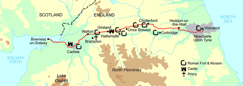
The Hadrian’s wall path is identified with the diamonds on the green dotted line, and I’ve highlighted in yellow thsi little walking route. I parked at The Sill: National Landscape Discovery Centre (Postcode NE47 7AN) and walked the 3 mile section of the wall from Steel Rigg to Housesteads Roman Fort, west to east. The frequent & punctual bus service is my preferred way to get back from Housesteads to Once Brewed! You can do a circular walk if you wish (and maybe take in Vindolanda on the way back) – but obviously this doubles the distance/time. WALK START AT THE SILL DISCOVERY CENTRE: |
 |
| This Hadrian’s Wall walk starts at the car park at The Sill Discovery Centre at Once Brewed in Northumberland. It’s worth a look inside here as it contains exhibitions, events, a cafe, shop selling local produce and even a Youth Hostel. You can find out more here www.thesill.org.uk |
Hadrian’s Wall – a Very Brief History…
Construction by the Romans began around 122 AD under the instructions of the Roman Emperor Hadrian. It stretches 73 miles across Northern England from the Solway Firth on the West Coast to Wallsend in the East Coast and at the time all land south of the wall was part of the Roman Empire. Apparently the wall originally was around 16-20ft high in many parts (see photoshopped image below), but now not much of it is left in terms of height – being only a few feet high in places.
 |
|
A photoshopped image found on the internet (link here) of how high the original Hadrian’s Wall was and how Hadrian’s Wall must have looked when it was built. Don’t get too excited it’s only a few feet high now….,
|
Despite popular opinion, there is still no agreement on why the wall was built, some believe it was built to keep the “Barbarians” north of the wall at bay (Scotland as a term had not yet existed – these so-called Barbarians were the Picts and the Celts). Some scholars say those north of the border where not much of a threat really and it could be more likely the wall was just built to reflect the power of Rome and how far its Empire stretched.
THE FULL HADRIAN’S WALL ROUTE – COAST TO COAST:
 |
|
The full Hadrian’s Wall Route from coast to coast. My walk was only a very short part of this, covering the best, most scenic route, and began at the ‘Once Brewed’ point on the map above.
|
 |
| Here’s what to expect! |
Photos from thE short 3.2 mile Hadrian’s Wall walk TO GIVE YOU A FLAVOUR OF the views YOU WILL SEE:
 |
| This is where we got on the actual Hadrian’s Wall path at Steel Rigg and we head east. |
 |
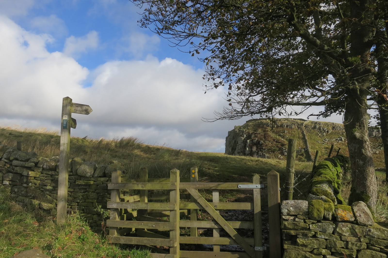
| The first time we glimpse Hadrian’s Wall on this walk, going up East towards Peel Crags. We would now follow a path next to the wall for just under 3 miles and you can see some of the hills you will have to walk up. |
 |
| View from the summit of Peel Crags looking back, towards Winshield Crags |
 |
| Walking east along Peel Crags to Milecastle 39 |
 |
| Coming down the hill to Milecastle 39 |
 |
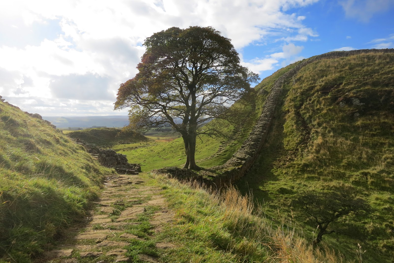
| First glimpse of Sycamore Gap, one of the best views on Hadrian’s Wall. |
Sycamore Gap, Hadrians Wall
One of the most popular and most photographed places on Hadrian’s Wall is (*was) Sycamore Gap, made famous in the Robin Hood: Prince of Thieves film. This walk was done in 2012 and you can see photos below of the iconic tree in Sycamore Gap (*2023 update – sadly the tree was chopped down by some absolute mindless idiots in 2023, so sadly this view of Sycamore Gap is no more)
 |
| The iconic Sycamore Gap on Hadrian’s Wall (pre 2023) |
Where is ‘Sycamore Gap’ on Hadrian’s Wall?
Sycamore Gap is located just to the east of Milecastle 39 (maybe only 100m or so) – if you look at the map at the top of this page – Milecastle 39 is to the east of Steel Rigg – and to be exact on the map above, Sycamore Gap is actually just above the ‘L’ on the text ‘MILECASTLE 39’ – so not far at all from Milecastle 39. The closest place to park to sycamore gap is Steel Rigg car park or Once Brewed Car Park) – and it’s about a 15minute walk east from these car park’s to Sycamore Gap.

Sycamore Gap is a popular place to stop on this Hadrian’s Wall walk for a rest and a bite to eat!
*SYCAMORE GAP, 2024 UPDATE
Since I blogged about this walk way back in 2012, you will probably be aware that the Sycamore Gap tree was illegally cut down by some idiots in September 2023 (see photo below). I couldn’t believe what I seen – it really was a shocking act of mindless vandalism by some absolute idiots against one of Britains best loved tree’s.

A SYMBOL OF OUR TIMES
Whilst utterly shocking in how people can mistreat nature, the Sycamore Gap story continues and may ultimately turn out to be one of hope and regeneration. After the felling of the Tree, the outdoor community came together, saplings were grown from its seeds, and will be cared for and looked after and planted all over the UK. Furthermore – the tree stump itself is regenerating, slowly (see pic below from spring 2024) and with care – the Tree itself may one day tower again in this spot (fingers crossed!)

HADRIAN’S WALL WALK 2012 – continued…
 |
| We get back on the path and leave Sycamore Gap behind – as you can see in this photo from the original post in 2012 |
 |
| Heading up to Highshield crags looking back to Sycamore Gap, Peel Crags and Windshield Crags in the distance |
 |
| Now the walk follows the side of Crag Loch |
 |
| A rare bit of shelter from the wind |
 |
| Looking back over Crag loch with Windshield Crags in the far distance |
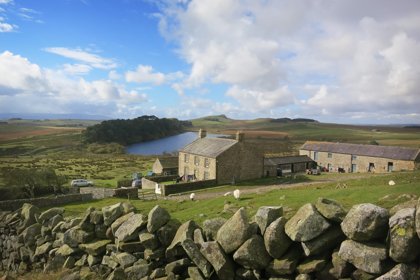 |
| The track now goes up beside Hotbank Farm House |
 |
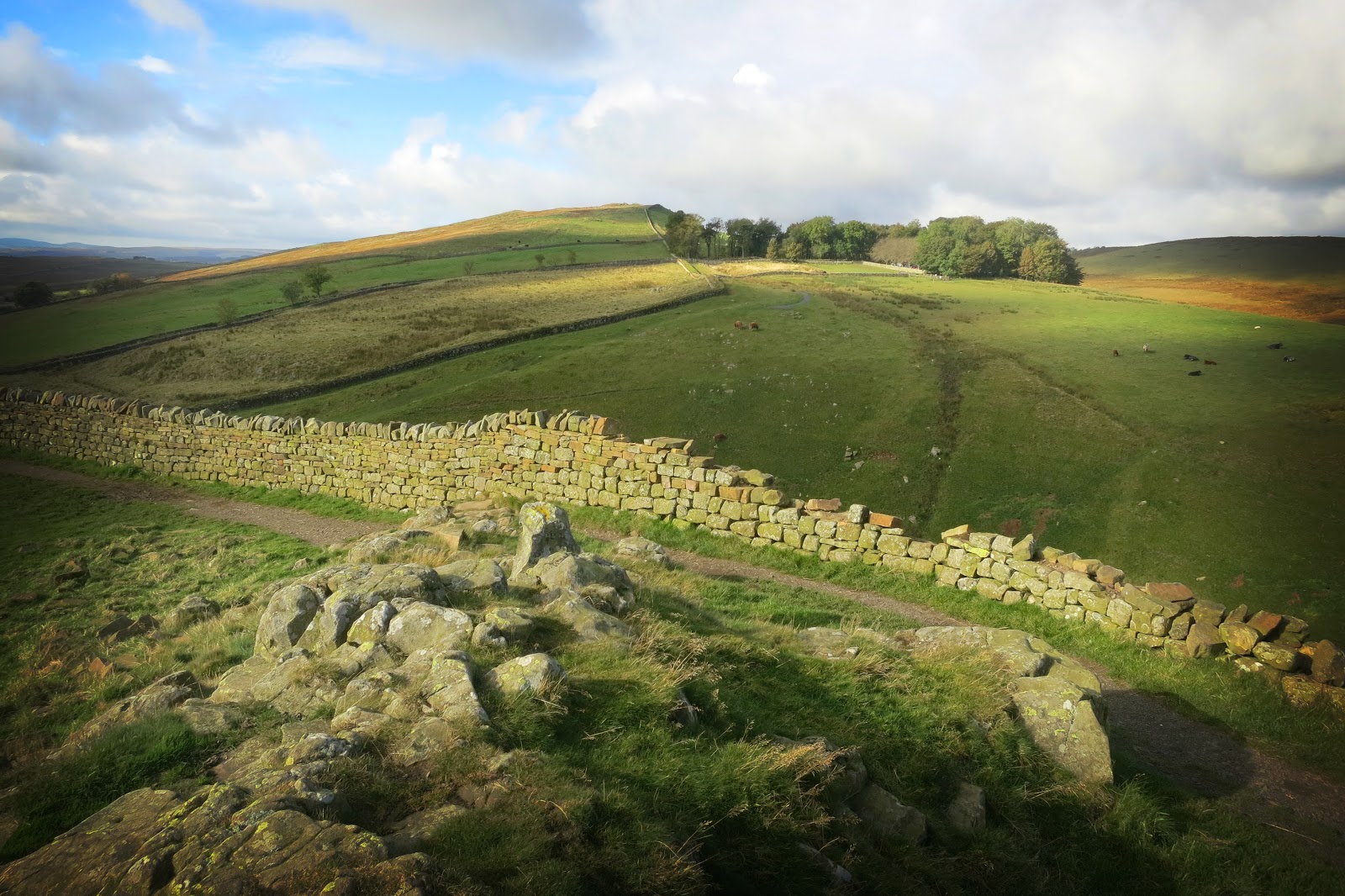
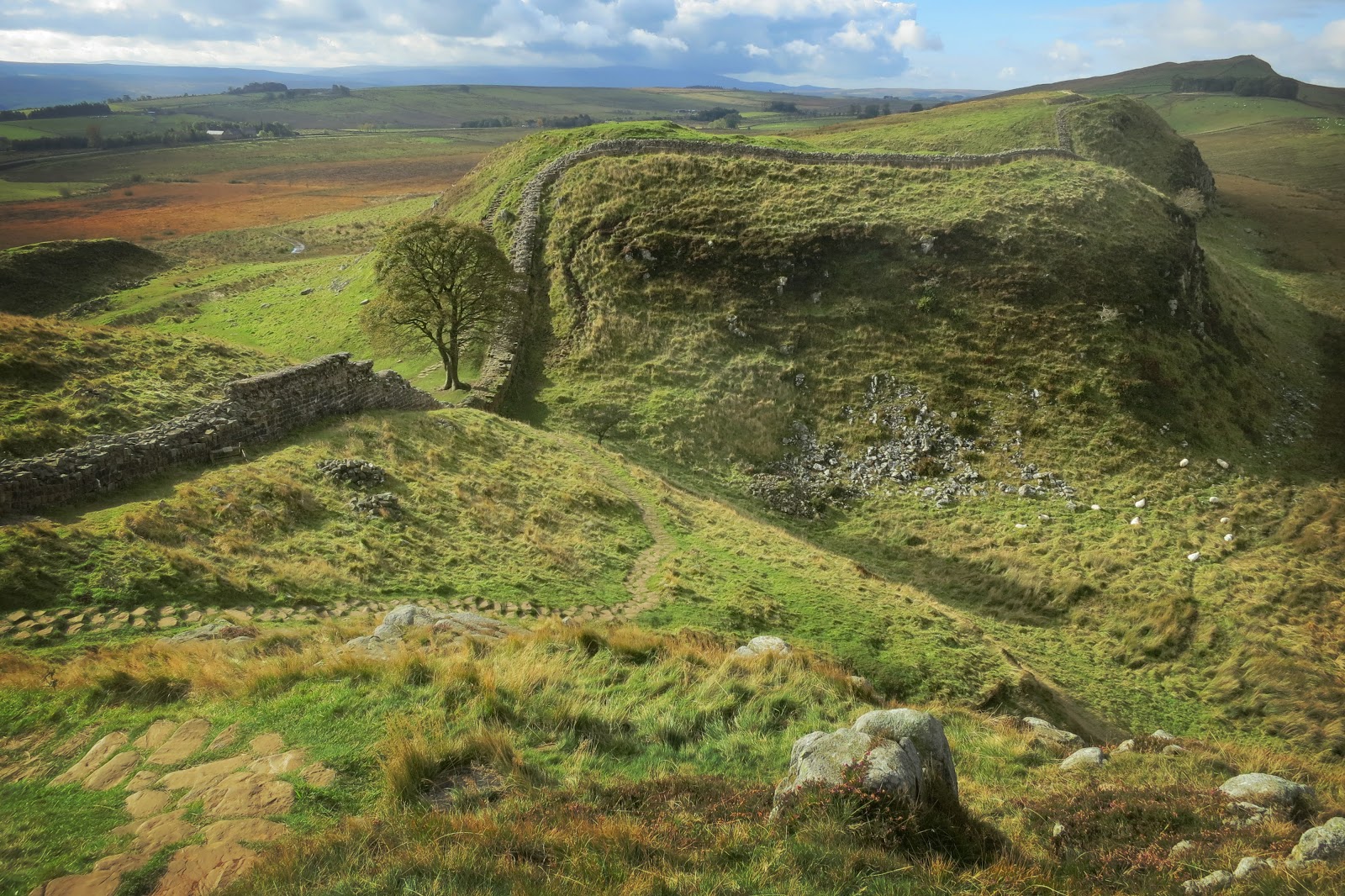
| This was one of the best views of the day on Hadrians Wall and you can see pretty much the entire route the walk along the wall has covered so far. |
 |
| This impressive view gives a real sense of the rugged, rolling Northumbrian landscape that Hadrian’s Wall covers and what a superb section of the wall it is to walk. |
 |
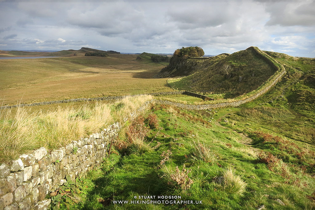
| Heading east right besides Hadrian’s Wall towards Housesteads Roman Fort with Broomlee Loch now in sight |
 |
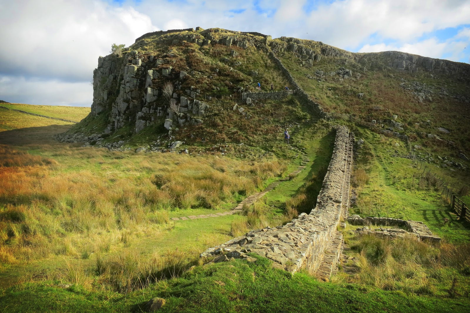
| There are quite a few ups and downs on this Hadrian’s wall walk but nothing too strenuous |
 |
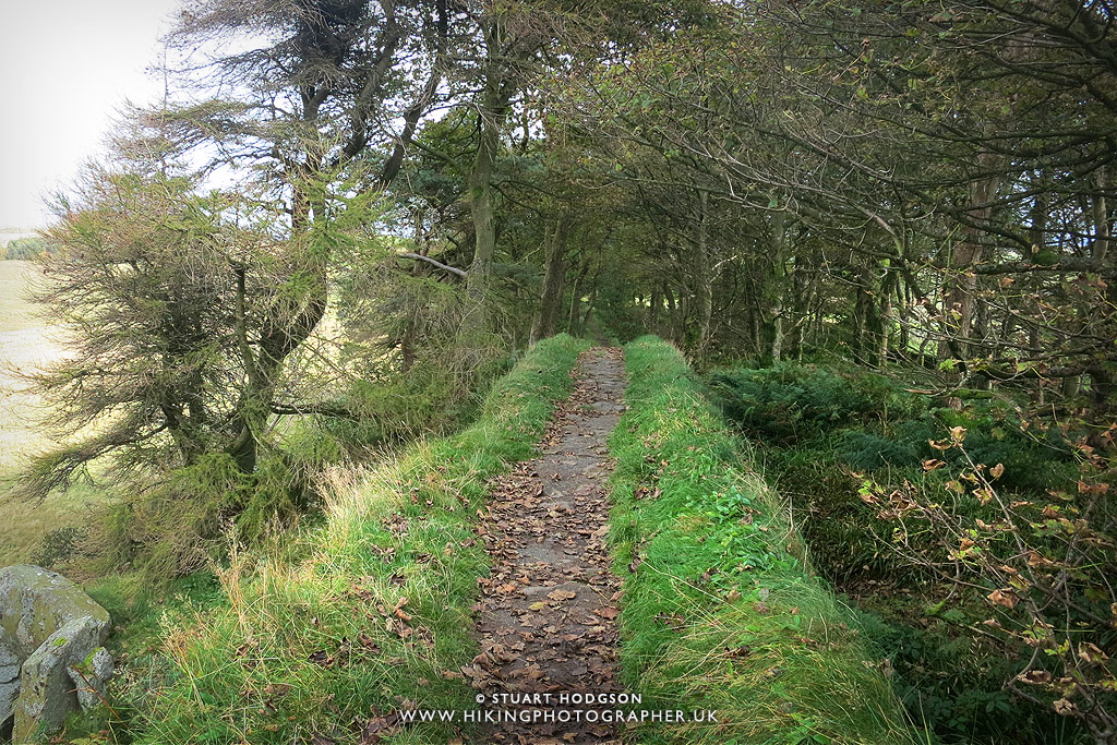
| I didn’t realise the Pennine Way came this far North. But on this walk we stay on the Hadrian’s Wall route 🙂 |
 |
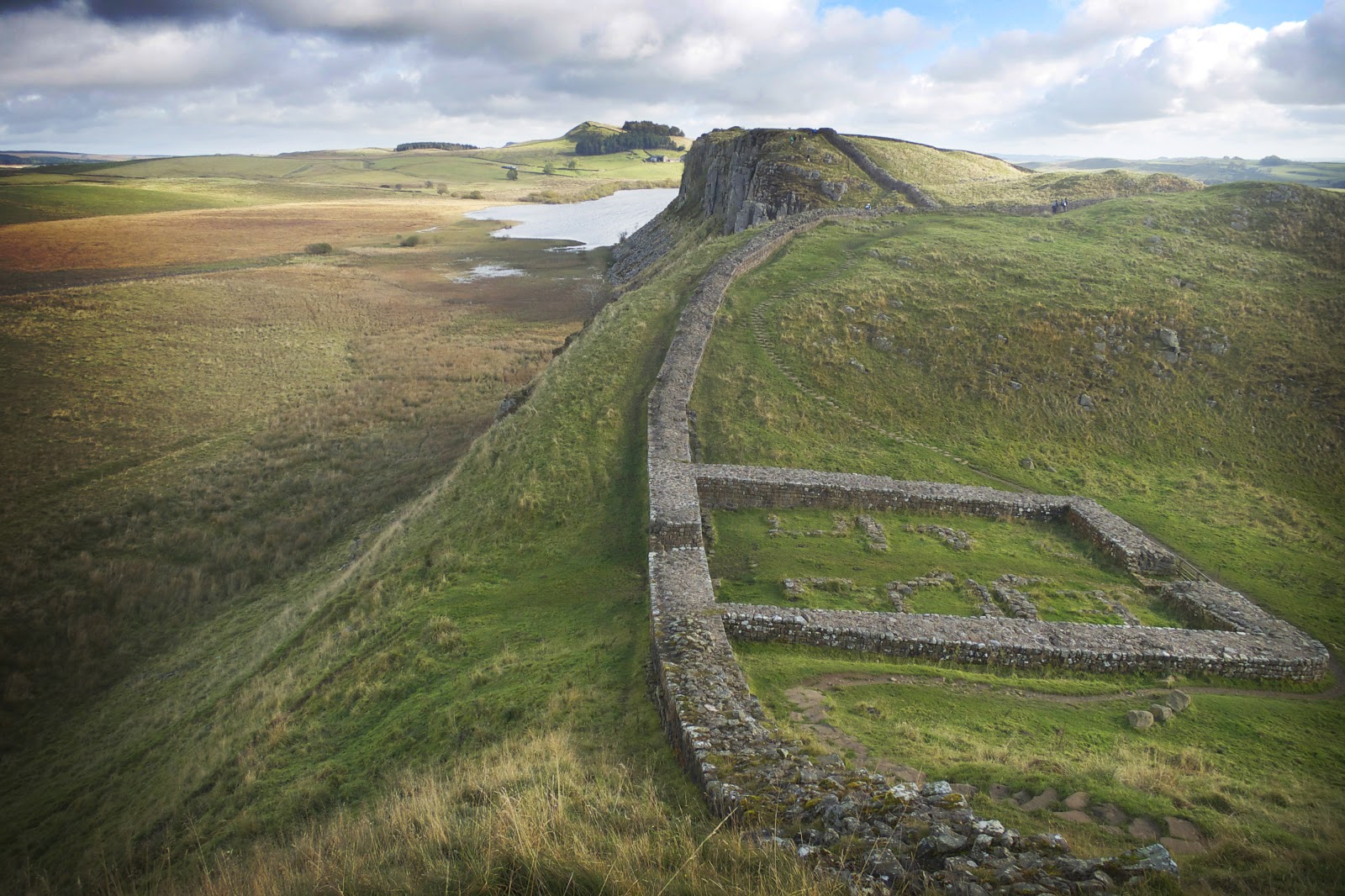
| Heading towards Housesteads Roman Fort – if you are looking for a classic Hadrian’s Wall view and one of the best bits on the Hadrian’s wall walk, then this view is it. This particular view is my own favourite view of Hadrian’s wall and indeed one of my best UK view’s – it makes for a great photo and is a nice place to stop and soak in the view |
 |
| Another photo of my favourite Hadrian’s Wall view – I told you I like it 🙂 |
 |
| The only part of the wall you can actually walk on as you approach Housesteads Roman Fort |
 |
| We’re nearing the end of the walk now right on top of Hadrian’s Wall and approaching Housesteads Roman Fort… |
Housestead’s Roman Fort:
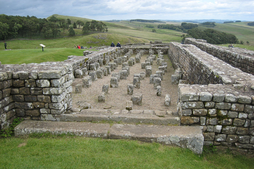 |
| The end of this particular Hadrian’s Wall walk finishes at Housesteads Roman Fort which is really well preserved and worth a good look around. Here you can see the remains of the Granary. The pillars supported a raised wooden floor to keep the food dry. You have to pay to see the Roman remains at Housesteads but if you have time (before the bus arrives) then it’s definitely worth exploring. |
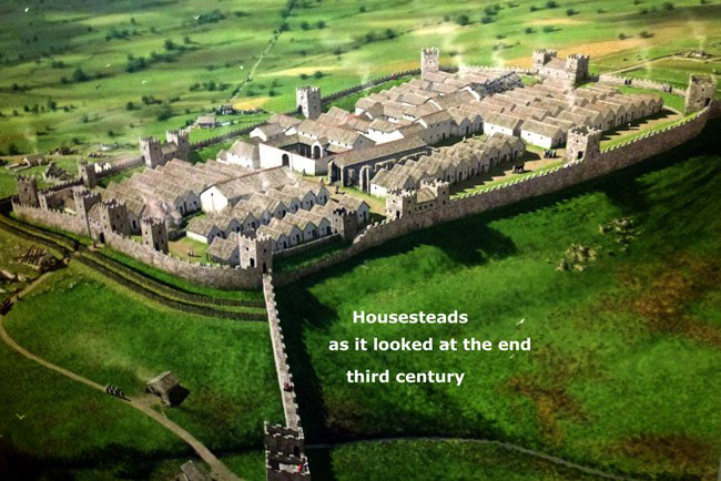 |
| How Housesteads Roman Fort will have looked at the end of the third century |
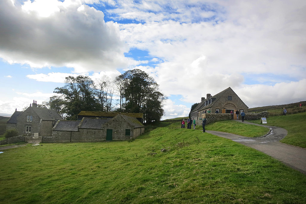 |
| Also at Housesteads is a visitor centre and a cafe to get a bite to eat and a drink. It is from Housesteads where you can also get the Hadrian’s Wall bus (see details below) back to the The Sill Visitor Centre car park and is what we did on this walk to keep it shorter as a linear route. |
FURTHER Information for your Hadrian’s Wall WALK:
The Hadrian’s Wall Bus (HWD Bus AD122)
In this walk to keep it at 3 miles, we got a bus back to The Sill from Housesteads, this saved us having to retrace out steps along the wall or walk back another way. If you want to see as much of the actual wall as possible, then a liner walk is probably best as you can go further, and the regular bus is very useful to get back to where you started! I found information on the bus service on the following link (The bus you want is the HWD Bus AD122 – it departs roughly hourly – but check the exact times first using this link http://hadrianswallcountry.co.uk/travel/bus )


Vindolanda & the Roman Army Museum
Vindolanda was a Roman auxiliary fort just south of Hadrian’s Wall in northern England, which it pre-dated. Archaeological excavations of the site show it was under Roman occupation from roughly 85 AD to 370 AD. It is pretty close to The Sill and you could adapt the walk above to return from Housesteads via Vindolanda.
At the Roman army museum, there is plenty on display and you can watch a really good 3D film about Hadrian’s wall called Edge of Empire, which gives you a taste of what the wall was like in Roman times. The film is on for 20 mins or so and runs every 30mins.
HADRIAN’S WALL FAQ:
What is Hadrian’s Wall?
Hadrian’s Wall is an ancient Roman fortification in Northern England, built to mark the northern boundary of the Roman Empire and to help control movement between Roman Britain and the northern tribes.
When was Hadrian’s Wall built?
The wall was constructed around AD 122 under the orders of Emperor Hadrian during his visit to Britain, reflecting the strategic and military priorities of the Roman Empire at that time.
Why was Hadrian’s Wall built?
It was primarily built as a defensive barrier to protect the Roman province of Britannia from incursions by northern tribes. The wall also served to control trade, migration, and to assert the power of Rome along its frontier.
How long is Hadrian’s Wall?
The wall stretches approximately 73 miles (117 kilometers) across Northern England, extending from the Irish Sea in the west to the North Sea in the east.
Can you visit Hadrian’s Wall today?
Yes, visitors can explore many well-preserved sections of Hadrian’s Wall. It is a popular tourist attraction with accessible walking trails, museums, and archaeological sites that offer insights into its historical significance.
 |
I hope you have found this blog post useful! I really recommend this must-do walk on the best section of Hadrian’s Wall – as it offers in my opinion the best of what Hadrian’s wall has to offer, and it’s one of the best walks in England for that matter so I hope this blog post inspires you to want to visit it.


Very helpful info for visiting the wall.
Glad you found it of use 🙂
Just the info I've been searching for! It is hard to find the exact location of Sycamore Gap which I have wanted to visit since first watching Robin Hood (Prince of thieves). I have recently found out it is part of Hadrian`s Wall which I have also wanted to visit for a long time! I am very happy to discover it will only take 1hr 30mins for me to get to Once Brewed. I am planning a trip for my next day off and will maybe camp over to give enough time to visit Roman fort at Housesteads and Vindolanda. Fantastic photos! Thanks so much 🙂
No probs Julie -I was pretty much the same of you. First seen it on Robin Hood – then discovered it was Hadrians Wall. However the wall is a long distance so I had to do as much research as I could to figure out where to go – there wasn't much info kicking around – so thought I would help people with this blog post! Enjoy your trip. I'd love to stay over the night up there so i could try and get some sunset/sunrise pics in the same area
Did this walk 2 weeks ago and thought it was awesome! Searched on Google and found your page Stuart. Great photos, and now I need to go and do it again cos i walked past the tree.
Good tips off here re. the bus and will use it next time.
More walks please!
Glad it was of use to you Darrell. I'll try and get more walks on here!
Great walk on Saturday 21st June 2015, brilliant and would love to do again some time. The car park is 4 pounds now but still good value.
Glad you enjoyed it Patrick – I must do it again sometime soon too!
Stuart thanks for posting this interesting info and lovely images.
Thanks for your positive feedback Paul and glad you liked the post