
 |
| You will get stunning views of Patterdale & Glenridding and Ullswater on this walk – one of the Lake Districts most popular walks |
Ullswater circular walk, around Place Fell from Sandwick via Patterdale overview:
WALK OVERVIEW:
DISTANCE: 7.2 miles
TIME: 4 hours
TOTAL ASCENT: 1647ft
DIFFICULTY: MODERATE

We made this route up on a recent visit to Ullswater, as it was a very hot day and we were a bit pushed for time, so we didn’t want to head to the steeper summit of Place Fell. Instead we basically walked around Place Fell and avoided the steepest part’s of the usual route to the summit of Place Fell. If you are feeling fitter than we where – then at Boredale Hause just head for the summit of Place Fell and then onto High Dodd and back to Sandwick. We started from Sandwick – but you can of course start this route from Patterdale too!
Ullswater circular walk map:
 |
| [Click to enlarge map] This circular walk from Sandwick goes in an anti- clockwise direction, basically circumnavigates Place Fell and takes in the magnificent shores of Ullswater for half of it, with great views of the lake & Glenridding. You’ll pass near to Patterdale and return via Boredale Valley bottom close to the beck. |

OS Maps - my Recommended App
I've tried a few map apps on my phone and settled on OS Maps, to access detailed UK Mapping. You can plan, save and download mapo routes, such as those on this site, direct to your phone, and then see where you are exactly on any route even when you have no signal - so you can't get lost! It's helped me discover loads of new walking routes too and you can get a free 2 week trial via the button below.
Ullswater circular walk photos:
|
| As we travelled into the Lake District from the east in a car – we decided to start this walk from Sandwick as it was the easiest place to get to and is a bit quieter than Howtown so avoiding the crowds there. |

 |
| From Sandwick we take the clearly marked footpath that will take us closer to the shores of Ullswater |
 |
| First glimpse of Ullswater on this fine and sunny day – not cloud in the sky – can’t be many days like that in the Lake District! |
 |
| Looking down the eastern section of Ullswater towards Howtown & Pooley Bridge in the far distance |
 |
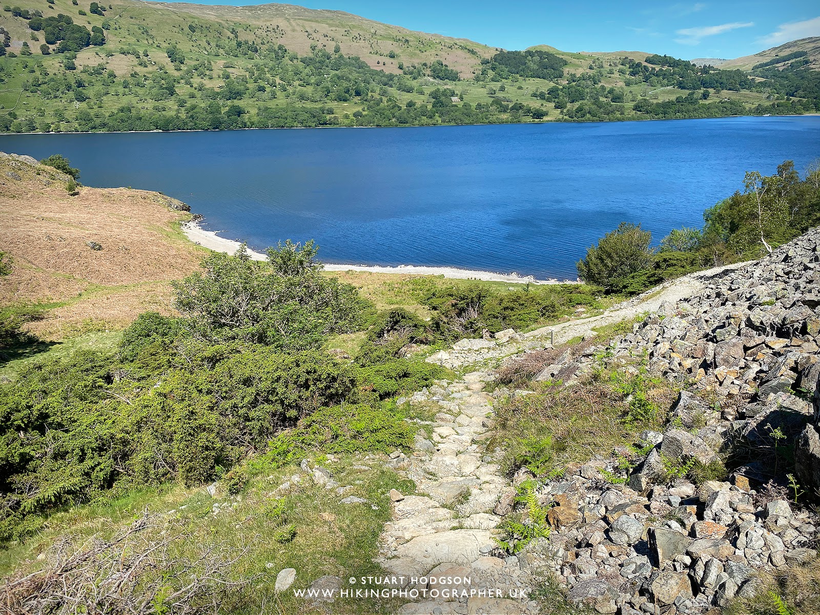
| This spot marks a good place to take the first rest and grab a snack and drink |
 |
| Looking nice and lush down here. |
 |
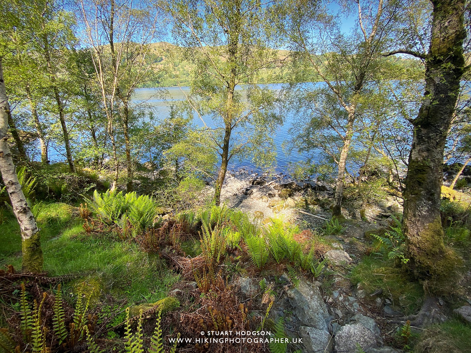
| With the temperature approaching 22˙C on this day it was tempting to take a dip in the lake – but we head up the path between Silver Crag & Birk Fell to gain a little height as the views of the lake will be better further ahead. Some people decide to stick to the path by the lake shore which is a little easier – but I think you get better views of Ullswater this way |
 |
| Looking back towards the path we’ve just come up – it’s quite sheltered up here and very warm on this day – like being abroad! |
 |
| Continuing on and another glimpse of the southern section of Ullswater |
 |
| Lovely views of Ullswater and Glenridding up here |
 |
| This is where we decide to chill for a bit and eat most of our packed lunch 😉 You can see the other path just below near the wall that most people take on this walk but I think you miss out on these great views by not doing this route |
|
| Stunning views of Patterdale, Glenridding and Ullswater on this walk |
 |
| We start heading up towards Boredale Hause and this seat is conveniently placed for some great views |
 |
| As we pass near to Patterdale, on this clear day you get excellent views of the Helvellyn range and Striding Edge in the distance |
 |
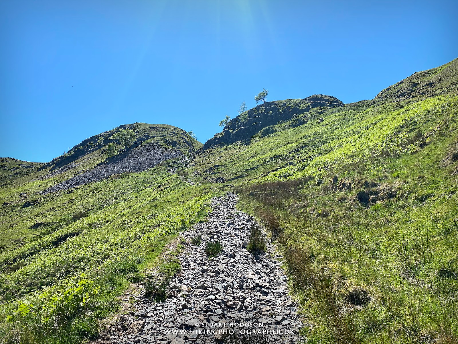
| Heading up towards Boredale Hause – the steepest walking part on this route |
 |
| You also get good views of Brothers Water and Kirkstone pass on the far distance |
 |
| Looking back over Patterdale & Glenridding |
 |
| As we approach Boredale Hause we catch the summit of Place Fell – and you could head for the summit on this walk and come back down the other side via High Dodd – but on this hot & sunny day we are making the walk a bit easier and circumnavigating Place Fell, so we cross Boredale Hause |
 |
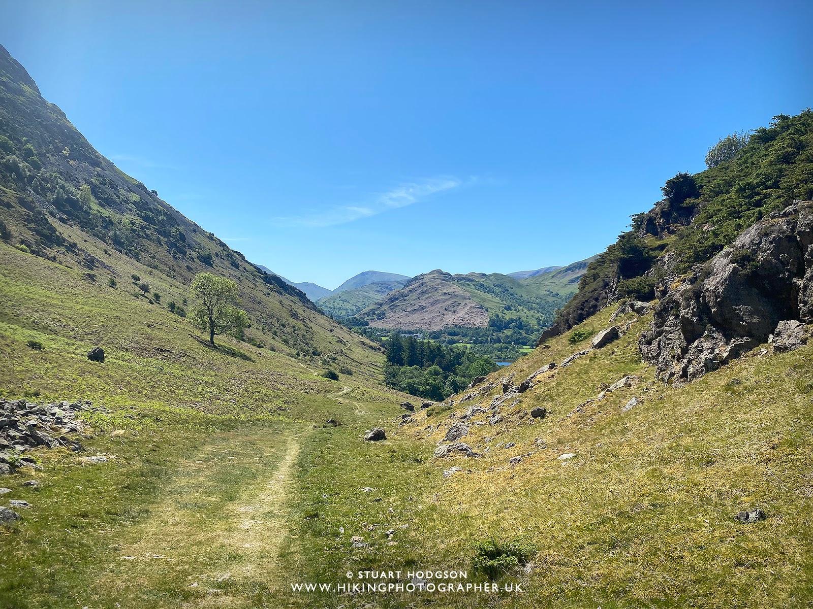
| Heading on the path towards Boredale valley |
 |
| Be sure to take the right path as you drop into Boredale Valley – as you descend the path becomes clearer |
 |
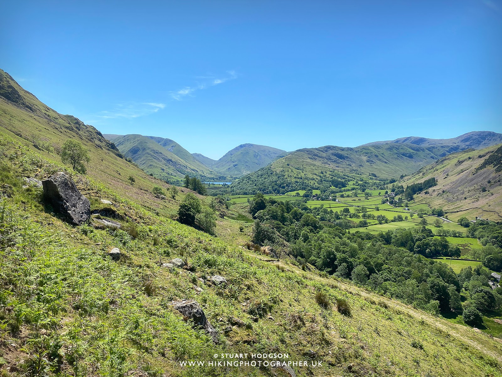
| Looking back at the point you drop down into the valley |
 |
| Looking back at where we have just come from. You can always do this circular walk in a clock-wise direction – but I think the anti-clockwise way is better 🙂 |
 |
| At this point we leave the stone path and the land under foot turns to road |
 |
| The last 2 miles are on this very quiet road and it makes it easier for some weary legs |
 |
| We’ve made it! And back at Sandwick! As ever I hope you have enjoyed this little write up and photos and it inspires you to want to visit the area and give the route a go. If you have any questions about this route – just post a comment and I’ll try and answer.
|


Hi. We are hoping to do this route from Patterdale. Do you have any info for how to do this? New to this place so would be really useful to have a step by step route to follow from Patterdale!
Thank you!
Hi Beth – yes really easy to adapt this route from Patterdale – if you look at the map shown – just park up at Patterdale – walk over the road bridge towards Side Farm campsite – and jump on the footpath there and follow the map route. It may help to click the OS Maps route button at the top of the page and save this to your phone to keep you on track – subscription required!